outdoors
Visit Los Alamos gives great suggestions of what to explore in the area. In addition to their recommendations, I will list my favorite places as well.
A word of caution. We live in a beautiful place, which we share with animals who used to live in this area for thousands of years. When outdoors, be aware and mindful of the animals who call this place their home. Following basic safety rules and using some common sense will ensure your safety.
Los Alamos is a bear country. Bears are frequent visitors in Los Alamos. They were seen in all parts of town, including the areas close to the townhouse. Please make sure your barbecue grill is cleaned after you used it (bears can smell barbecue grease for miles)and doors are closed when you are not in the room. A good advice on what to do when you encounter a bear can be found here or in this video. Most attacks happen when people move fast (running, biking), or a mother protects her cubs.
Occasionally mountain lions visit the town. While they are rarely seen during the day, it still might be helpful to know what to do during the encounter. Rattle snakes are native to Southwest, and can be seen on the ground, as well as in the trees. Watch out for the holes in the ground where they like to live. In the heat of summer, rattle snakes prefer to stay below the ground, or in the shade behind the rocks and fallen trees. Teach your kids to put their hands and feet where they can see them and check with sticks places behind the rocks before touching. Be careful in tall grasses near water. Snakes like to get out when the temperature is warm, but not hot - in the evenings in summer, and during the days in September and October.
If you have pets, be aware of coyotes, who live around the town. Coyotes were known to attack small dogs and cats in town. Don't leave pets outside unattended.
The majority of the encounters with wild animals are safe, non-threatening, and fun as long as you follow the safety rules.
During your time outside, keep an eye out for the weather, as long as the monsoons last (July and August). Remember, if you hear thunder, the US Weather Service advises you to get to a car as quickly as you can… no “let’s go a little farther” delays. If bolts are crashing around you, look for a group of small trees, jettison anything metallic, squat on the balls of your feet (never lie down or put your hands down), wait it out. Of course, avoid being the tallest thing around (be glad you’re short!). And now back to outdoors!
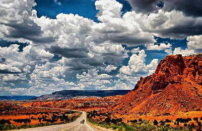
LOS ALAMOS TRAILS
To explore trails in Los Alamos, try a Free Los Alamos Trails app. It is very, very helpful and accurate. Maps of trails are available from the Visitor Center and PEEC. 50 hikes in Los Alamos and LA county have a good summary of local trails. For the best paper guide, nothing beats Los Alamos Trails by local hiking expert Craig Martin. Craig is now retired, but gives talks and leads hikes with Los Alamos Nature Center (PEEC). The book is available at PEEC for $14.95. Hiking Adventures in Northern New Mexico is another great book for exploring the area. It is out of print now, but sometimes you can find it at the library book shop.
Below are some nice summer trails.
Trails in Acid Canyon. (These trails are located behind the Aquatic Center. The trailhead is well marked with the bench and the map, and located to the left of the entrance). Other favorites are Dot Grant trail, Rendija trail, Woodland trail, Bridges Loop, Canada Bonita and Water Canyon (Water Canyon trailhead is the last trailhead on the right on West Jemez Road (NM501), between Anchor Ranch Road and the Back Gate (Back gate is the nickname for the junction of N.M. highway 4 and West Jemez Road)). All of these trails are easy on the feet, and have at least some shade.
Good trails for cooler seasons:
Canyon Rim Trail. A very easy, asphalt surfaced trail close to the townhouse (starts by the Fire Station at 457 East Road, 2 min drive). Be careful with the small pets, as coyotes live nearby and visit the trail regularly. Anniversary trail, White Rock Canyon Rim Trail (stunningly beautiful), Kwage Mesa, Olive Street trails (start at Olive street by the Family Strength Network building). All these trails are easy for all ages.
AROUND LOS ALAMOS
BANDELIER NATIONAL MONUMENT
It's a must for the town's visitors. Caves that kids can climb into, Indian dwellings, petroglyphs, and 70 miles of trails. Entrance fee is $20 or free with the Nationals Parks pass. Calendar of events is here.
Other trails in this area include the 3 mile round-trip Falls Trail to the beautiful Upper Falls and various trails of different lengths and difficulty leading up to the mesa tops.
Tsankawi
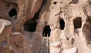
The Tsankawi section of Bandelier National Monument is 12 miles from the main section of the park. At Tsankawi you take a 1.5 mile walk along a mesa, viewing cavates, petroglyphs and the Ancestral Pueblo village of Tsankawi. Climbing ladders is a required activity at this site. May not be appropriate for the kids younger than 5-6 y.o.
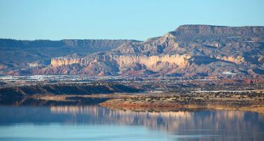
Valles Caldera National Preserve
If you are looking for some solitude, Valles Caldera is a great place to hike or bike. Entrance fee is $20 or free with the Nationals Parks pass. You can take your car to explore the area of Caldera (although the dirt roads may not work for some cars). This is included in fee, but call to make sure they have spots available, as the number of cars allowed in the park is limited. All events (clinics, tours) are covered by the entrance fee. Very friendly and helpful personal. If they are not busy (usually they are not), they can give you a ride to the history Groove house, pick you up if you got caught in the rain, or kids are too tired to make it back. Some retired Lab's employees volunteer there, so you might get a lesson in Manhattan project in addition to the history of Valle :) Calendar of events is here.
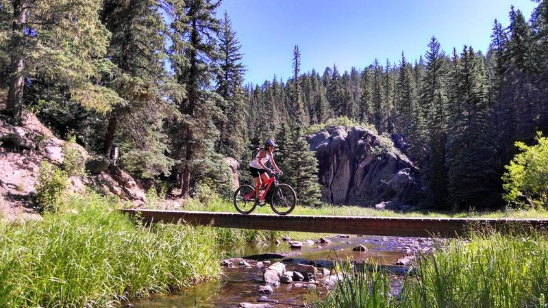
Las Conchas Trail
Las Conchas trail is one of the most beautiful trails in Jemez. It is about 30 minutes drive from the townhouse. Kids love it, as there are plenty of opportunities to play in the water and cross bridges. Partially shaded. In winter gets too cold and icy. As with most places in Jemez, come on weekdays for better parking.
Directions to Las Conchas trail: turn right at the intersection of Diamond and West road (intersection is located by the hospital, immediately before the bridge leading to LANL). Continue on West Road past ice skating rink, past the turn to Camp May until you come to West Jemez Road. Turn right and continue to the junction of N.M. highways 4 and 501/West Jemez Road. Take a right (away from Bandelier National Monument), following the highway up and into the Jemez Mountains. Remain on Highway 4 for about 13.5 miles. The trailhead is between mile markers 36 and 37.
Just before the trailhead, you will pass the Las Conchas fishing access area, which has restrooms and picnic tables, but only a short hiking trail, which is also beautiful. In about .25 mile, you will arrive at the Las Conchas Trailhead, which has a small parking area and a sign that says “Las Conchas Trailhead, Trail 137”. If no parking is available at this parking lot, you may go back about 100 yards, where another parking area for rock climbers is located. There are two ways down to the trail from the Las Conchas parking lot. The gate on your right will lead you to the steps, which might be difficult to master for some kids. The gate on the left will lead to an easy, shady walk down to the main trail. It's a good idea to bring some extra snack and a change of clothes as kids usually get wet.
JEMEZ FALLS TRAIL
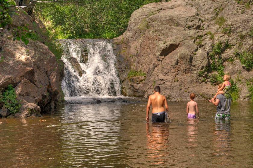
Directions: turn right at the intersection of Diamond and West road (intersection is located by the hospital, immediately before the bridge leading to LANL). Continue on West Road past ice skating rink, past the turn to Camp May until you come to West Jemez Road. Turn right and continue to the junction of N.M. highways 4 and 501/West Jemez Road. Take a right (away from Bandelier National Monument), following the highway up and into the Jemez Mountains. Remain on Highway 4 for about 18 miles. Turn left onto Jemez Falls Road. The trail starts at the end of the road, where the picnic area is. If you go to the left of the falls, you will find a few shallow pools where kids usually like to play. Another trail that starts at the picnic area will take you to the Battleship Rock.
Cave of the winds
Fun hike for kids right here in Los Alamos! The Cave of the Winds is actually very small – just one chamber that dead-ends a few dozen meters in. There doesn’t seem to have been much evidence of water here (it’s a very dry cave and there are no speleothems), so I’m guessing it’s just a crevice in the tuff that was enlarged a bit by other processes. Our guide mentioned that it was used by the campers at the Los Alamos Ranch School, and undoubtedly homesteaders and people traveling the trails here knew about it before that.
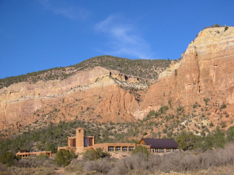
GHOST RANCH
A gorgeous drive through the vast vistas, table-topped mesas, tall cliffs, the Rio Chama bordered by huge old cottonwood trees, mountains in the distance and more beauty around every bend in the winding road.
A road leading to it is a dirt road, and may not be suitable for all cars. Allow an extra hour or so to cover 13 miles.
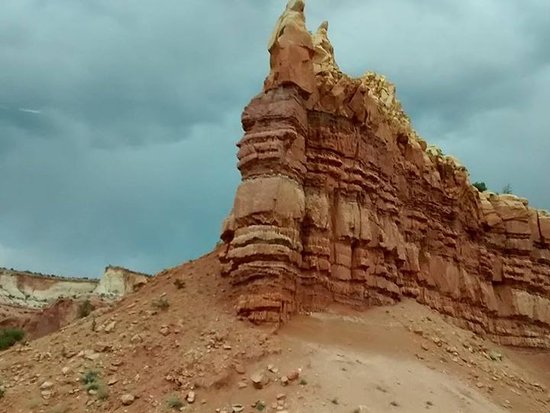
Echo Amphitheater
12 minutes drive from the Ghost Ranch will take you to another spot that can't be missed - Echo Amphitheater.
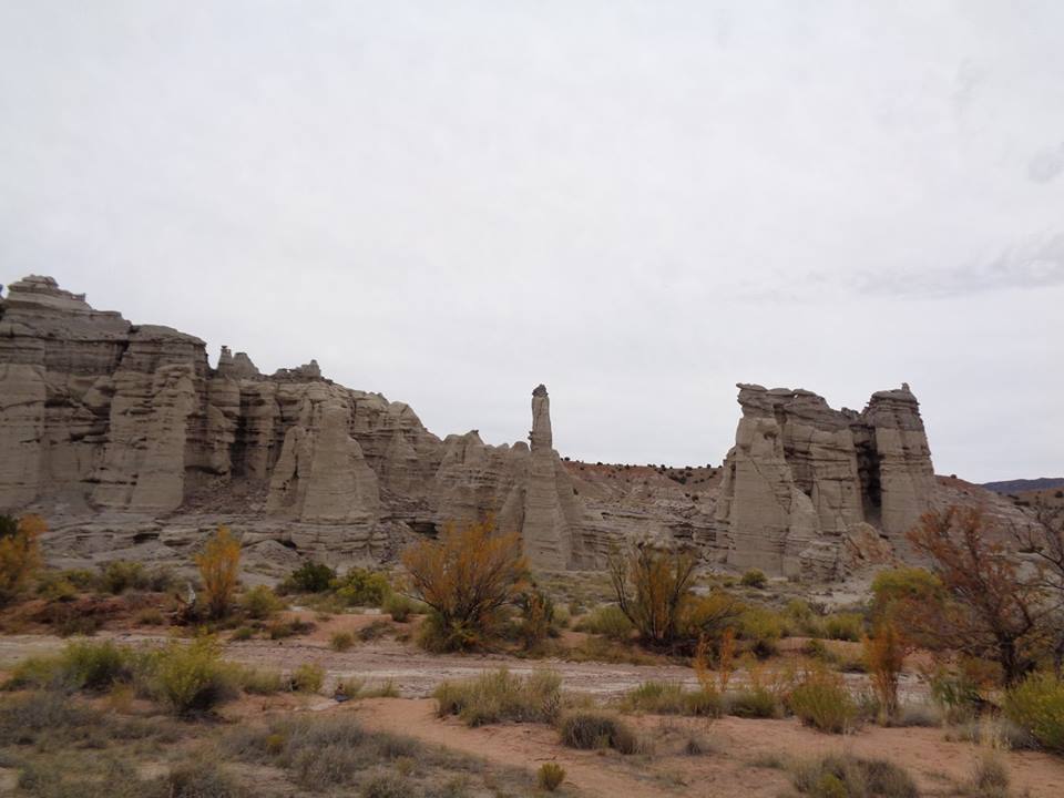
PLAZA BLANCA
Another great place for hiking not far from Ghost Ranch and Abique lake. As well as hiking up to the Plaza Blanca itself there are great hiking trails around and into the red-rock country of Ghost Ranch which is just 20 miles away. Near there is also a Box Canyon Hike which is very mild and easy gradients with plenty of trees for cover even in summer. Hart Canyon Trail is also a great choice.
While there, stop by at Dar al Islam, a non-profit organization dedicated to cultivating greater understanding of Islam among Americans of all faiths.
Close by are the remarkable pueblo Tsiping Ruins. To go there you need to obtain a permit from the Coyote Ranger Station
48 minutes drive.
MORE ABIQUIU LINKS
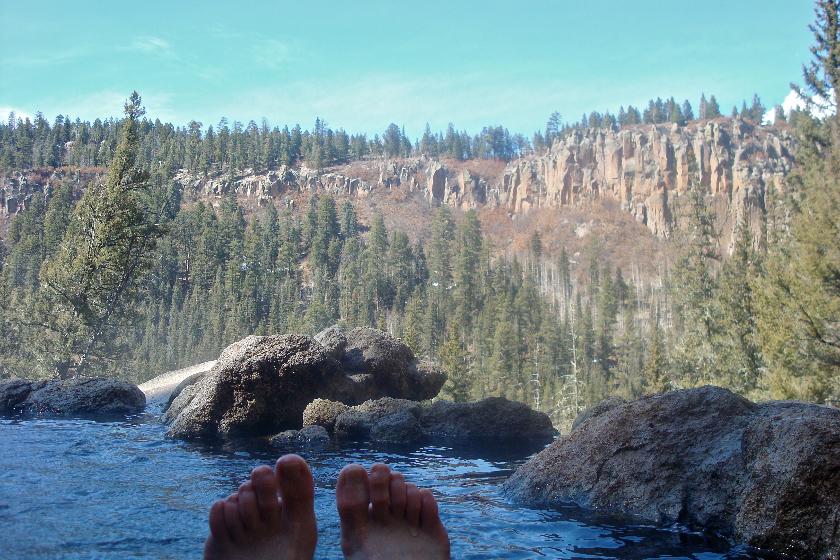
SAN ANTONIO HOT SPRINGS
Free, and the most awesome Hot Springs in the area (other hot springs listed here). 5 miles hike. The very best part of the hike starts past the springs, but the hike to springs is still very nice. And when you soak in the pools, looking at the gorgeous mesas around, you realize, that a 5 miles hike isn't really much for this beauty. In fact, if you only could afford, you would gladly did it every day. You might meet some enlightened beings there, as this area is popular for sole meditation retreats. However, be careful at the parking area, as there were reports of broken car windows (apparently the radius of enlightenment does not exceed 5 miles). 50-60 minutes drive to the trailhead, and 5 miles to hike. There are two shortcuts however, which are closely guarded by locals. Ask at La Cueva Store and you might get lucky.
Local blogs about outdoors adventures
Another list of local trails with details and maps
Archaeological ruins in Jemez and other places
Long list of hikes from Albuquerque hiking group
More recreational opportunities
Aquatic Center with the Olympic size swimming pool
Tennis courts (the best is at Urban Park, the closest two are at the Myrtle and Canyon streets)
If you have questions about the outdoor activities, don't hesitate to ask them in the local Facebook groups: Los Alamos Trails, Outdoor kids Los Alamos (organizes weekly hikes with kids), Los Alamos Tuff Riders Mountain Bike Club, Los Alamos Ski Club - Pajarito Mountain, Los Alamos Geological society.
If you have any other questions about Los Alamos, a great place to ask (and get answers!) is a Facebook group KEEP IT LOCAL.